Quantum GIS (QGIS) Course Overview

Quantum GIS (QGIS) Course Overview

Quantum GIS (QGIS) certification attests to a user's proficiency with QGIS, an open-source Geographic Information System (GIS) software. It showcases an individual’s ability to analyze spatial information and create geospatial maps and data visualizations. Industries use QGIS for its versatility in managing and interpreting geographical data, which aids in urban planning, environmental conservation, resource management, and infrastructure development. By leveraging QGIS’s powerful tools for spatial analysis, data integration, and cartography, professionals can make data-driven decisions and convey complex spatial concepts in an accessible format. This certification indicates a level of expertise essential for conducting intricate GIS tasks efficiently.

Purchase This Course

Fee On Request

  • Live Training (Duration : 40 Hours)
  • Per Participant
  • Guaranteed-to-Run (GTR)
  • Classroom Training fee on request
  • Select Date
    date-img
  • CST(united states) date-img

Select Time


♱ Excluding VAT/GST

You can request classroom training in any city on any date by Requesting More Information

Inclusions in Koenig's Learning Stack may vary as per policies of OEMs

  • Live Training (Duration : 40 Hours)

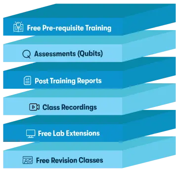
Koeing Learning Stack

Koeing Learning Stack

Scroll to view more course dates

♱ Excluding VAT/GST

You can request classroom training in any city on any date by Requesting More Information

Inclusions in Koenig's Learning Stack may vary as per policies of OEMs

Request More Information

Email:  WhatsApp:

Suggested Courses

What other information would you like to see on this page?
USD

Koenig Learning Stack

Inclusions in Koenig's Learning Stack may vary as per policies of OEMs